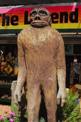
 Bigfoot!
Wow, what a ride! The Tour of the Unknown Coast is a century ride in Humboldt County, CA. In case you haven't figured it out from the wood carving pictured on the left, this is Bigfoot country. Good looking fellow, huh?
The Bay area is considered Northern California. However, Ferndale (the little town where this ride starts) is 300 miles north of where I live!
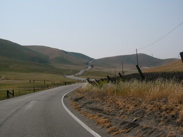
The area is beautiful - old growth redwoods, deserted beaches, rugged terrain (some of the hills go up 2,000 feet almost from the beach), lots of cows - you really do feel like you've gotten far away from it all.
The town of Ferndale is really nice - 100+ year old victorian houses sitting down in a valley right near the coast. In fact, Ferndale is considered at risk for a Tsunami, and the road into town (is there more than one?) is marked as an emergency escape route.
We had dinner in a restaurant in one of those old victorians - the food was all organic and really good. I loaded up on a pesto pasta dish, but other teammates had pizza or chicken or steak - great variety, and the food was all great. That by itself was almost worth the 5 hour drive! The restaurant
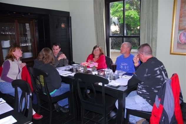 was La Petite Maison (www.lapetiteferndale.com) if you ever happen to be in the middle of nowhere, California and want a first-class meal.
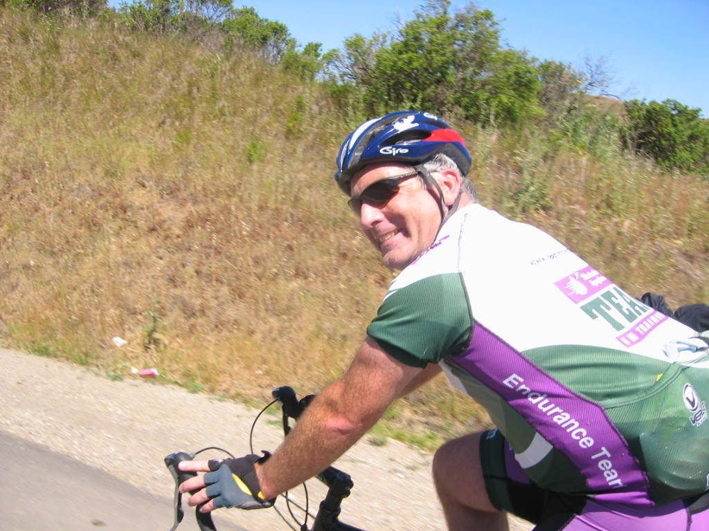
Since we needed to get up early, we all turned in around 9 (not that it mattered, since the whole town was pretty much shut down by then too). Up before 6 to start the ride by 7! It was cool (ok, my teammates all said it was cold), but the sun was already burning through the coastal fog - a beautiful day for a bike ride!
The Ride
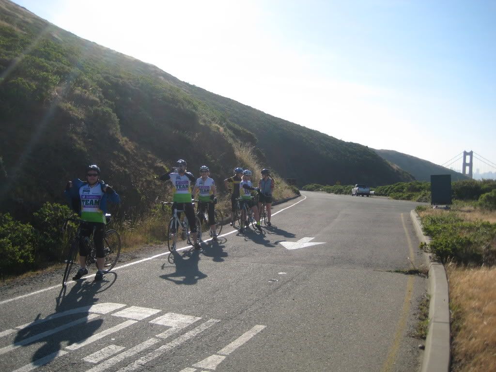
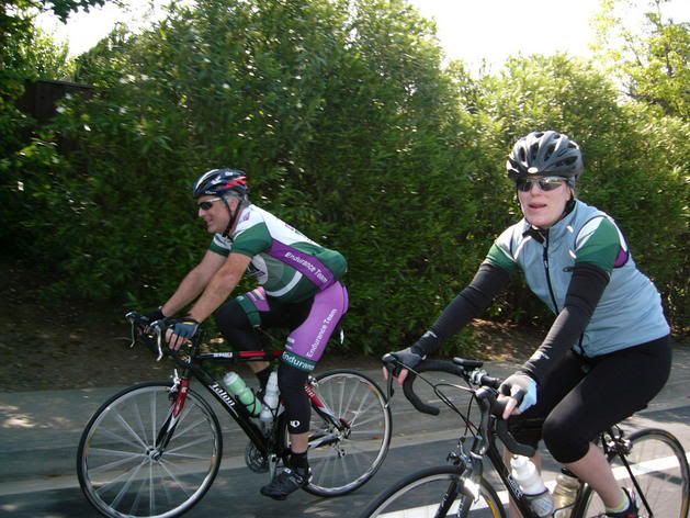
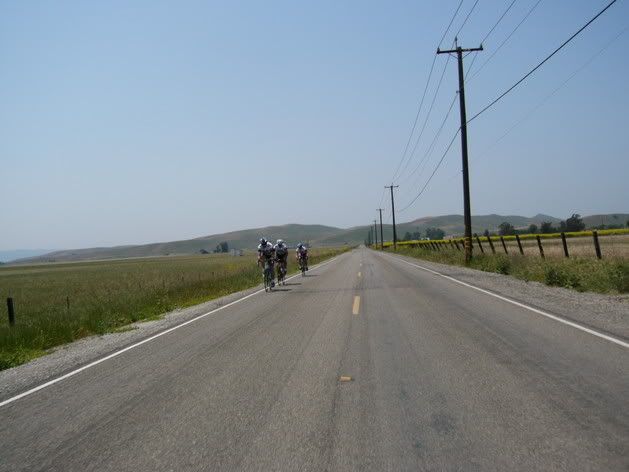
We knew we weren't going to be the fastest riders out there, so we let the main pack get going at 7 - we left just a few minutes behind. This was a weekend where we didn't have an organized team ride, but 2 of the coaches were with us, and a total of 12 of us from the TnT Death Ride team were riding. One wanted to get a headstart, and left before the official start at 7, 4 others (including our intrepid coaches) are pretty fast and didn't see the point of leaving quite that early, so that left of 7 of us rolling right after the main pack.
The early part of the ride is kind of a gentle wake-up call. At least 25 miles of scenic, bucolic, gently rolling miles through
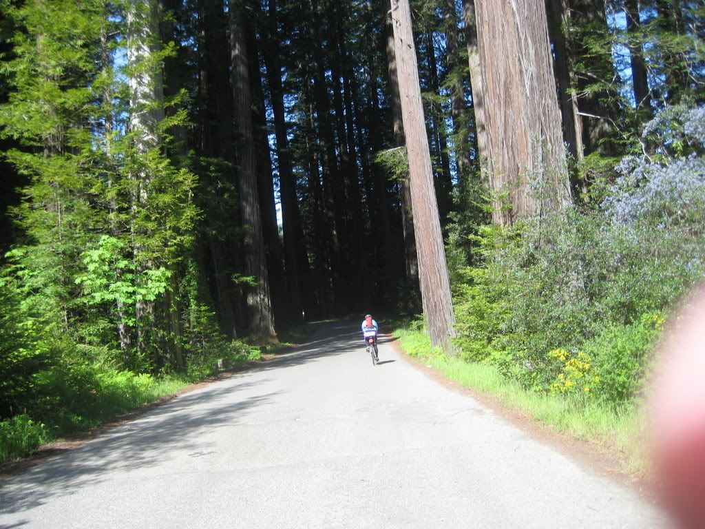 the countryside, culminating with a cruise down the Avenue of the Giants, amid ginormous old-growth redwoods. This area is beautiful!
Part of the Avenue of the Giants was washed out, so we ended up riding on Highway 101 a bit more than expected, but since that was by far the smoothest pavement we saw all day, that was a good thing. The road quality is really bad up there - low population means not much road usage, which means not much state $ to maintain the roads. There were plenty of areas where there was more patched surface showing than original road pavement, and plenty more where they'd patched the patches - multiple times. Hard on the bikes (I saw plenty of flat tires), hard on your hands and hard on your butt (here's a secret about cycling - the better shape you are in, the less weight you have on the seat - you naturally start carrying it with your legs, so rough roads don't bother you as much).
After we left the Giants, we rolled through a younger area of woods. The road quality deteriorated in a hurry as we rolled along, but the scenery was so nice that you didn't notice (that much). At some point, Rick and I had rolled away from the rest of our starting group - 2 of the riders were doing the 50 mile option, while the rest wanted to go at a slower pace. Rick and I rolled through the first 2 rest stops, just stopping quickly at one to refill a water bottle.
We did stop at the third one - this one was right before the first big climb of the day - Panther Gap. It was a long, fairly hard climb - it went up 2,400 feet or so in about 8 miles. At this point, I passed a rider with a very loud bike - every time he pedaled, his bike made a creaking noise. I wasn't that much faster than him, so I got to listen to "creak creak creak" for several miles. I asked him if something was wrong, but his reply was that the bike had made the noise since it was new! I refrained from pointing out that bikes weren't supposed to make that noise, even if they were brand new - I had to bite my tongue pretty hard.
Anyway the road quality did not improve for the descent. Lots of potholes and rough pavement. However, there always seemed to be a safe line through the turns that wasn't so bad, so as long as you looked ahead you could maintain a decent pace down the hill. Some people were a bit freaked out, though, and were riding the brakes all the way down, trying to pick their way through. I don't think they had much fun.
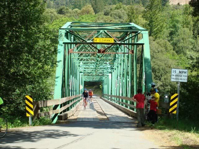
After the descent was an old wood-plank bridge. Very picturesque - and a fall waiting to happen! However, I made it across without catching my tires in the gaps between the planks (a teammate was not so lucky but wasn't hurt when he fell) and then we had an easy 9 mile cruise into the lunch stop.
Lunch was just about perfect for a long bike ride, at least by my standards. Some people were complaining that they didn't have the fancy, gourmet food served at some centuries, but the turkey sandwiches and minestrone hit the spot for me.
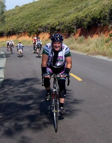
 After lunch was a set of "rollers". What I call rollers are a set of hills where the momentum off of the last downhill carries you most (or, even better, all the way) up the next hill. Not this time. Between how steep and long these hills were, along with the lousy road quality, trying to maintain momentum was a lost cause. So, each hill was a schlep up - not so fun, but still not really hard.
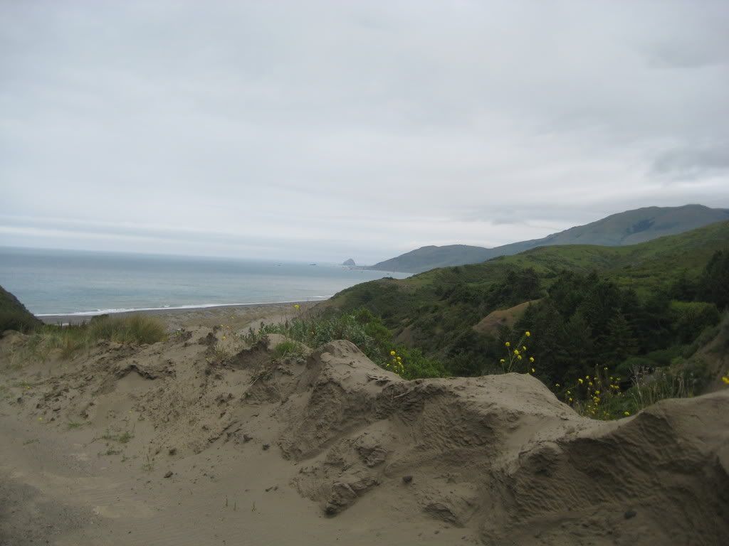
After a while, we finally reached the lost coast. A fast short descent led us down to the flat 9 mile or so ride along the ocean to the infamous "Wall". I hate it when they name a climb after a
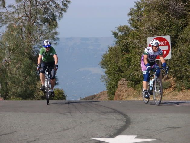
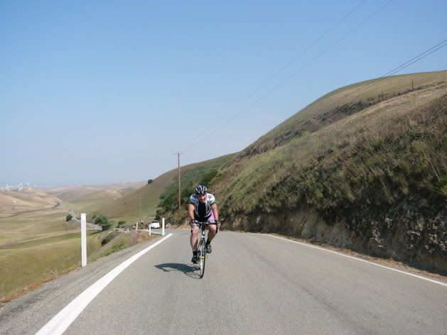
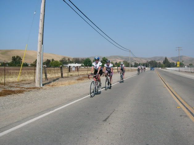
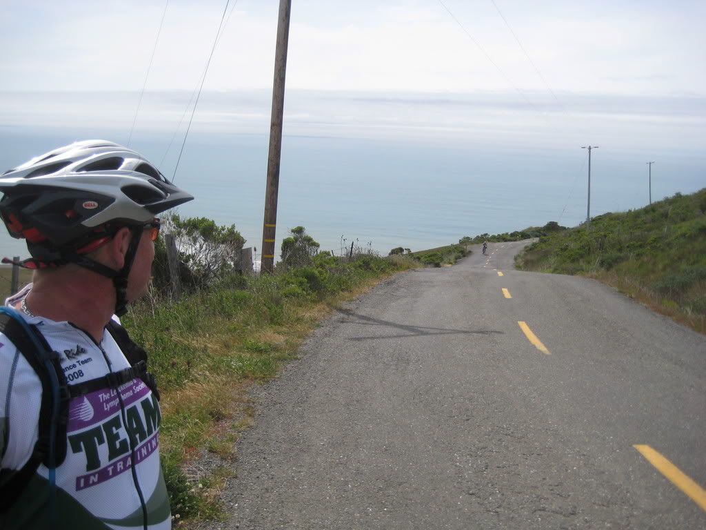
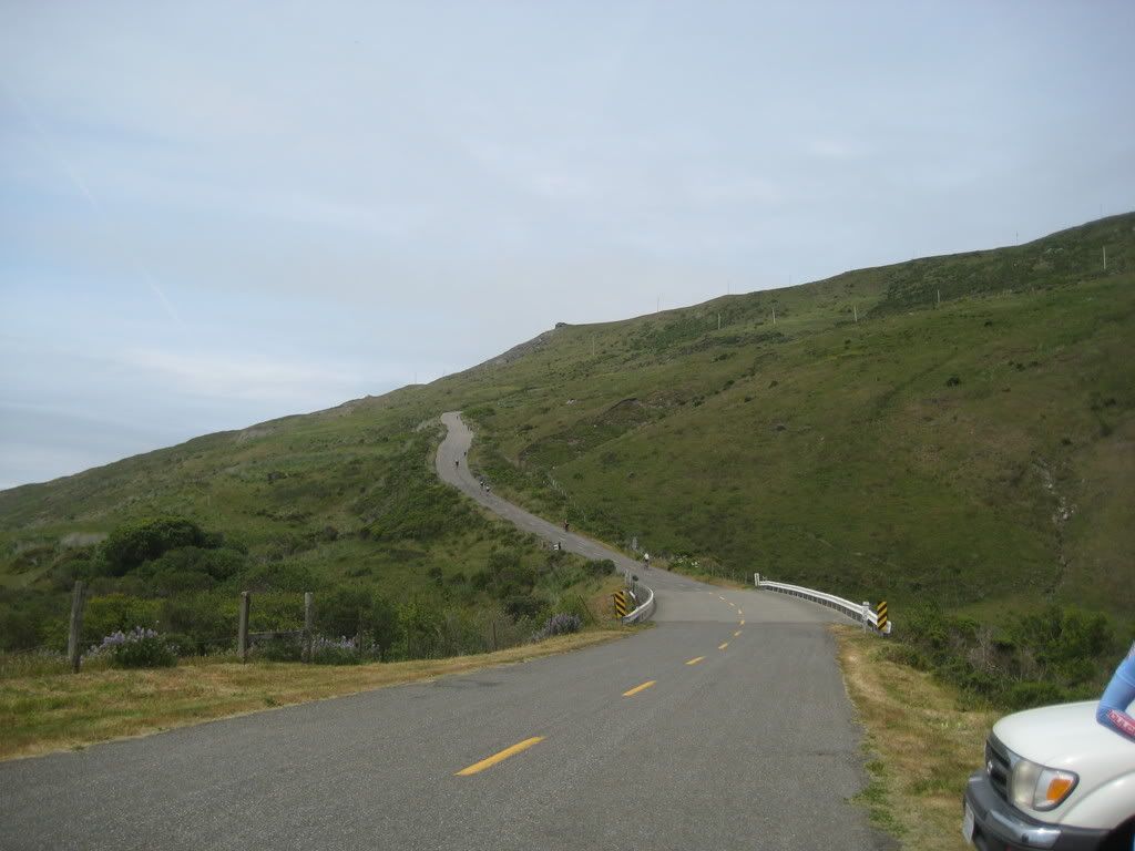 wall! In this case, it's a well-chosen name. It is definitely one of the steepest sustained climbs I've done. Sure, some switchbacks on various climbs are steeper. But this puppy is 18% or so for about a mile. What's worse is that you get to see it coming! We stopped at the rest stop at the bottom of it for about 15 minutes, and watched others work their way up. Most made it, so we saddled up and went for it. I went very slowly - at one point, I was only going 2mph. I was a little surprised I could go that slow and stay upright! I made it, and didn't get too far outside of my heartrate zone to do it. If you look carefully at this picture of Rick to the left, you
 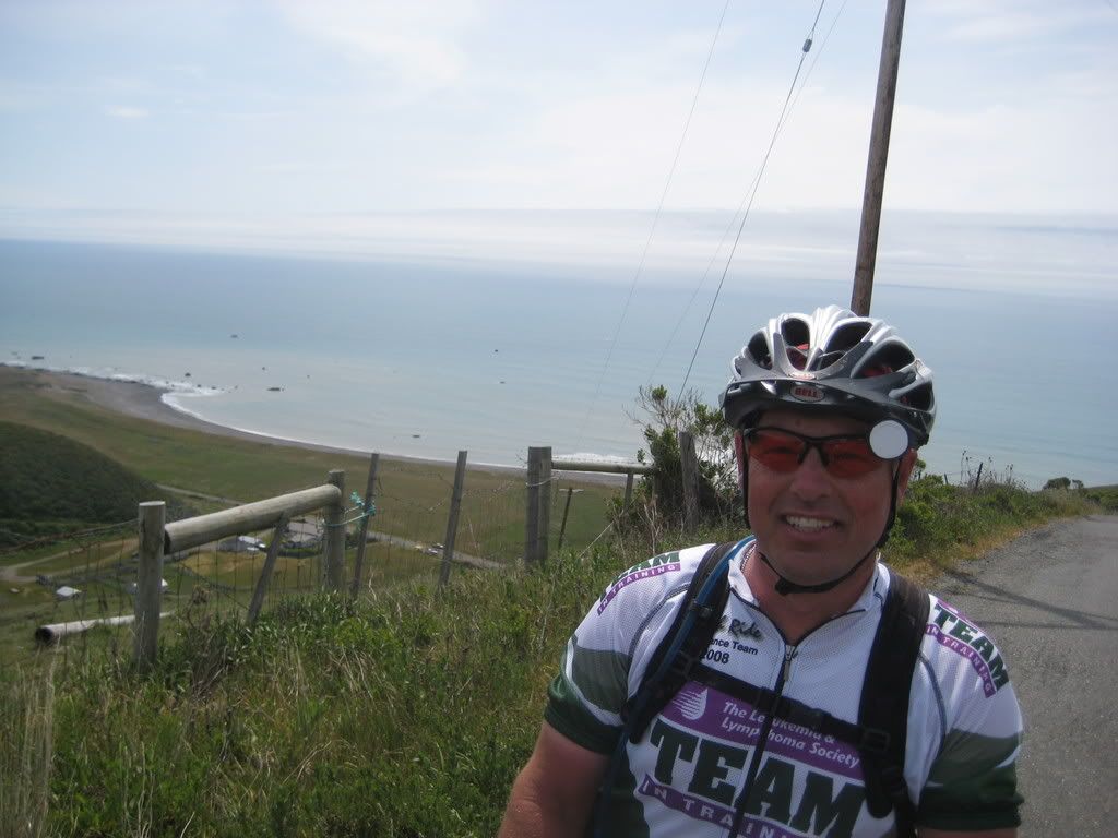 can see the rest stop tent - it's that little yellow dot near the house. (hint - click on the picture to see a full resolution version) We went up that high in less than a mile!
After the Wall and a nasty descent (steep and bad road quality - really bad combination), we had the Endless Hill. Steep for a couple of miles, then 6 more miles of a more gradual climb. It wouldn't have been so bad - except this was mile 88 or so. I was definitely feeling sore and tired at this point, but there was nothing for it but to keep going. We made it to the top and then got the last descent of the day - over more rough, beat up, poorly patched road. Oh, yeah, and a
 couple of short uphill sections just to keep us honest.
All in all, a beautiful, hard ride. I'll be doing this again in the future, but I'm thinking I'll use a bike that can take larger tires next time (to help smooth out some of the bumps!)
The Fundraising Continues
A quick reminder that I'm training with Team in Training as a fund-raiser, and I need all the help I can get to reach my fund-raising goal of $5,000. We're almost half-way there, but the deadline is approaching fast! And don't forget, I've pledged to ride a mile for every dollar donated through my website. So far, I've got it covered, but you can add to my pain by donating HERE